OS1/35/19/3


| List of names as written | Various modes of spelling | Authorities for spelling | Situation | Description remarks |
|---|---|---|---|---|
| LOW SALQUHARIE | Low Salchrie Low Salchrie Low Salquhary Low Saughrie Low Salquhary Low Salchrie Low Salquharie |
Hugh Bell William Ross Rl. Engrs. [Royal Engineers] Map 1819 Ainslie's map 1782 Admiralty Chart 1839 From proprietors List furnished by G. McHaffie Esqr. George McHaffie Esqr. |
009 | [Situation] In the SE [South East] Corner of KirKcolm Ph. [Parish] About 1/2 mile N. [North] of Soleburn Mill A low thatched farm house and office houses in bad repair with a farm attached occupied by Hugh bell N.E Side of this farm house on the Sea Shore is a Trigl. [Trigonometrical] Station Called by Trigl. [Trigonometrical] "Low Salchrie" it being on the farm of Low Salchrie and at the distance of about 3/4 mile to the N.W. [North West] of the above Trigl. [Trigonometrical] Station is another called "Salchrie High" from it being on the farm of High Salchrie The property of Sir A Agnew Bart. [Baronet] |
Continued entries/extra info
[Page] 10C -- Trace 1 -- Parish of KirkcolmForm 136
Page 37- Low Salquharie
Note - Salachar - Filthiness, nastiness
Ballysalach - Irish - [Filthiness, nastiness]
Salach
Transcriber's notes
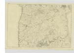
On Six inch Plan 009Transcribers who have contributed to this page.
Chr1smac -Moderator
Location information for this page.
Linked mapsheets.