OS1/35/10/23


| List of names as written | Various modes of spelling | Authorities for spelling | Situation | Description remarks |
|---|---|---|---|---|
| DRUMREGOS | Drumregas Drumregos |
Informant could not spell the name William Gordon KirKcalla |
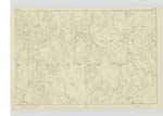
007 | [Situation] In the N.E [North East] parts of the Parish. A Trigl. [Trigonometrical] Station deriving its name from the undermentioned Hill A Hill uncultivated on the farm of Polbae. This is also known as Big Munrogie See page 22 |
| DRUMMACONNELL | Drumconnell Drummaconnall Drumaconnel |
William Gordon Proprietors Map 1776 Proprietors Map 1845 |
007 | [Situation] In the NE [North East] part of the Parish & South of Loch Baberry. A Hill partially Cultivated on the farm of Polbae. |
| DRUMJENNING | Drumgenning Drumjenning Drumgunyon |
William Gordon George McHaffie Esqr. Proprietors Map 1845 |
007 | [Situation] In the N.E [North East] part of the Parish. A Hill on the Farm of Polbae. |
| POLBAE BURN | Black Burn of Polbae Black Burn Polbae Burn |
William Gordon John McClure Meresman for Kirkcowan Proprietors Map 1845 |
007 | [Situation] In the North part of the Parish A Small Stream running thro [through] the farm of Polbae where it falls into the River Bladenoch |
Continued entries/extra info
[Page] 23Parish of Kirkcowan
Form 136 Page
44 Drumregos - Big Munrogie written on the plan.
35 Drummaconnell
35 Drumjenning
Polbae Burn - Altered by authority of Captn. [Captain] Tucker
Thomas M. Nightingale
O.M.O [Ordnance Mapping Office] 21st. Septr. [September] 1846
Transcribers who have contributed to this page.
Chr1smac -Moderator, DANIALSAN
Location information for this page.
Linked mapsheets.