OS1/35/9/11


| List of names as written | Various modes of spelling | Authorities for spelling | Situation | Description remarks |
|---|---|---|---|---|
| POLBAE BURN | Polbae Burn Palbae Burn The Black Burn of Polbae Polbae Burn |
John Paterson Proprietors Map 1845 Mr. William Gordon George McHaffie Esqr. |
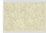
007 | [Situation] In the northern part of the Parish. A small Burn which rises on the east side of Craigmoddie Fell runs east through the Farms of Polbae Derry & DarlosKine and a short distance east of DarlosKine Bridge falls into the River Bladenoch. |
| SUN FAULD | Sunfall Sun Fauld |
Samuel McClure George McHaffie Esqr. |
007 | In the northern part of the Parish. A low uncultivated hill on the farm of DarlosKine. |
| BARNACLAGNAHIE | Barnaclagnahie | Samuel McClure | 007 | In the northern part of the Parish. A rough Heathy Hill on the farm of Derry. |
Continued entries/extra info
[Page] 11Parish of Kirkcowan
Form 136 Page
32 Polbae Burn
33 Sunfall
33 Barnaclagnahie
[Signed] WS Loop Secd. Corp RS&M [ Second Corporal Royal Sappers & Miners]
Transcribers who have contributed to this page.
Chr1smac -Moderator, DANIALSAN
Location information for this page.
Linked mapsheets.