OS1/33/30/68


| List of names as written | Various modes of spelling | Authorities for spelling | Situation | Description remarks |
|---|---|---|---|---|
| STRATH TOLLIE | Strath Tollie Strath Tollie Strath Tollie Strath Tollie Strath Tollie Strath Tollie Strath Tolly Strath Tolly |
Angus McKay, Dalmore, Rogart Robert McKay, Strathan, Dornoch D. Macpherson, Pittentrail, Rogart A. Hall Esqr. of Calrossie Map of Sutherland 1833 Map of Sutherland 1852 Sketch Plan of Torboll Farm 1832 G. Barclay Esqr, Davochbeg |
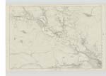
104 | Applies to a small valley formerly inhabited, nearly a mile northwest of the house called Brae in Strath Càrnach |
| DAILEAG AN LÒIN | Dail nam Boireannach Daileag an Lòin Daileag an Lòin Daileag an Lòin |
Ordnance Survey original authorities Robert Mackay, Strathan Angus McKenzie, Rogart. Rev. [Reverend] JM Joass LLD. [Doctor of Laws]. Golspie |
104 | Means "little dale of the marsh or meadow Applies to a piece of flat ground covered with heath & rough pasture about 1/2 mile north west of Brae. (The name Dail nam Boireannach appears to have been collected from the fact that a woman once lived here, but that name is not generally known.) |
| MEALL CLAIS NAN EACH | Meall Clais nan Fiadh Meall Clais nan Each Meall Clais nan Each Meall Clais nan Each Meall Claishnaneach |
Ordnance Survey, as collected by Examiner D Macpherson, Pittentrail Robert Mackay Rev. JM Joass, LLD [Doctor of Laws] Map of Sutherland 1852 |
104 | Means "lump of the hollow of the horses". See description in Name Book. (The examiner has given the wrong [word/s] for this name which has been turned into wrong Gaelic accordingly.) |
Continued entries/extra info
[Page] 68Transcribers who have contributed to this page.
CorrieBuidhe- Moderator, KBMW- Moderator
Location information for this page.
Linked mapsheets.