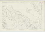
OS1/23/16/125
| List of names as written | Various modes of spelling | Authorities for spelling | Situation | Description remarks |
|---|---|---|---|---|
| BROUGH [a house] | Brough | I. Reid, Occupier. Plan of Rousay by I. Traill 1872. Mr. Murrison, Factor. |
089 | This name is applied to a cottar house & farm buildings situate about 1 mile N.W. from 'Westness' & 16 chains N.W. from 'Skail'. The houses are all one storey, built of stone, thatched and in fair repair. Adjacent to and betwixt houses & high water mark, is what appears to have been a 'Brough' or ancient Pict stronghold. |
| BROUGH [Brough] | Brough | 089 | ||
| CHURCH (In Ruins) [Skaill] | Church (In Ruins) | 089 | 4 chains W. from Skail stands the ruin of the old parish church. It is in a good state of preservation surrounded by a graveyard and enclosed by a stone dyke. The graveyard is in use at present as a burial ground as recently made graves testify. | |
| SKAILL | Skaill | I. Reid, Occupier. Plan of Rousay by I. Traill 1872. Mr. Murrison, Factor. |
089 | This name applies to a cottar house similar to the above situate 16 chains S.E. from 'Brough' partly in ruins. |
Transcriber's notes
Brough [Brough]: No additional information is supplied - i.e. Authority for Spelling or Description RemarksTranscribers who have contributed to this page.
Muriel Rousay
Location information for this page.
Linked mapsheets.


