OS1/11/43/13


| List of names as written | Various modes of spelling | Authorities for spelling | Situation | Description remarks |
|---|---|---|---|---|
| HARBURNHEAD HILL | Harburnhead Hill Harburnhead Hill Harburnhead Hill |
John Lind John Watson Coy [County] Map. |
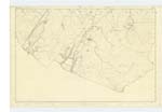
016 | [Situation] Nearly ⅞ mile E. [East] by S. [South] from the North end of Cobinshaw Reservr [Reservoir] A Small hill on the farm of Harburnhead, the Surface of which is heathy pasture and Wood, on its Summit is a a Trigl [Trigonometrical] Station called "Harburnhill". |
| OTTER BURN | Otter Burn Otter Burn Otter Burn |
John Watson John Lind Co [County] Map |
016 | [Situation] About 1¼ Miles E. [East] S. E. [South East] from the North end of Cobinshaw Reservr. [Reservoir] A Small Stream having its Source on the farm of Crosswoodhill and flowing in an easterly direction into Powfastle Burn |
| POWFASTLE BURN | Powfastle Burn Powfastle Burn Powfastle Burn |
John Kerr John Lind Co [County] Map. |
016 | [Situation] About 1½ Miles S. E. [South East] by E. [East] from the N. [North] end of Cobinshaw Reservr. [Reservoir] A Small Stream, rising on Crosswoodhill farm and flowing in an easterly direction into Crosswood Burn. |
Continued entries/extra info
Parish of West Calder [Page] 13Transcribers who have contributed to this page.
Molly Miller
Location information for this page.
Linked mapsheets.