OS1/20/9/8


| List of names as written | Various modes of spelling | Authorities for spelling | Situation | Description remarks |
|---|---|---|---|---|
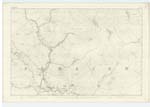
| POLSHAGG BURN | Polshagg Burn | Plan 5D | 005 | [Situation] Running in a South Easterly direction from the South side of Beninner For Description see Name List for Plan 5D. |
| MOORBROCK HILL | Moorbrock Hill Moorbrock Hill |
Thomas Stewart James Sloan See Name List Plan 2D |
005 | [Situation] About 1 7/8 miles NE by E [North East by East] of WalKers Cairn A considerable hill or part of a range, And is part of the farm of Moorbrock The Surface is rocky pasture |
| GAIRY OF CAIRNSMORE | Gairy of Cairnsmore Gairy of Cairnsmore |
Thomas Stewart James Sloan See Name List Plan 2D |
005 | [Situation] About ¾ mile N. by E [North by East] of WalKer's Cairn. A rocky precipice on the east side of Cairnsmore, and near to the Trigl. [Trigonometrical] Station "Cairnsmore on Deugh" |
| BLACK BURN | Black Burn | Thomas Stewart William Wilson See Name List Plan 2D |
005 | [Situation] Running in a Southerly direction passing E. [East] side of Moorbrock Hill. A Small Stream having its rise on the farm of Moorbrock & running in a S.[South] westerly direction passing Moorbrock Hill & NE [North East] side of Green Hill meets another Small Burn and is then called Poldores Burn |
Continued entries/extra info
[Page] 8Parish of Carsphairn
Transcribers who have contributed to this page.
DANIALSAN, Gerald Cummins
Location information for this page.
Linked mapsheets.