OS1/20/41/74


| List of names as written | Various modes of spelling | Authorities for spelling | Situation | Description remarks |
|---|---|---|---|---|
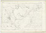
| GLAISTERS HILL | Glaisters Hill | James Chesney n.s Craigenputtock via Minnyhive J. Muirhead n.s. Drumwhirn Toll Bar via Corsock |
017 | A heathy hill of considerable extent (but of little elevation) on the farms of Upper & Nether Glaisters on its summit is a Trigl. [Trigonometrical] station called by that party "Gloster Hill." |
| GLAISTERS BURN | Glaisters Burn | James Chesney n.s Craigenputtock via Minnyhive J. Muirhead n.s. Drumwhirn Toll Bar via Corsock |
017 | A small stream rising on the farm of Blackmark and flowing in a westerly direction to its influx into the "River Urr". During its whole length it is a boundary line between the parishes of Dunscore and Kilpatrick Durham, and between the shires of Kirkcudbright and Dumfries. - |
Continued entries/extra info
[Page] 74Parish of Kirkpatrick Durham
Plan 17A Trace 8 -- List of Names collected by 2nd Corporal P. Quin RS&M [Royal Sappers & Miners] 1st Examiner
Objects
Glaisters Hill - A hill
Glaisters Burn - a stream
Transcribers who have contributed to this page.
Chr1smac -Moderator, CorrieBuidhe- Moderator
Location information for this page.