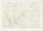
OS1/20/38/11


| List of names as written | Various modes of spelling | Authorities for spelling | Situation | Description remarks |
|---|---|---|---|---|
| LOCH SKAE BURN | Loch Skae Burn | Robert Grierson | 016 | [Situation] Running N.W [North West] to its junction with Blackmark Burn about 7/8 mile NW by N. [North West by North] of Loch Skae. A small stream or burn having its rise out of Loch Skae and running in a N. [North] Westerly direction to its conflux with Blackmark Burn. |
| LOCH SKAE | Loch Skae Loch Skae Loch Skae |
Robert Grierson Ainslies map. 1820 Stat. Acct. [Statistical Account] of Kirkt. [Kirkcudbright] 1845 |
016 | [Situation] 3/8 Mile E by N [East by North] of Laggan farm house A small lake on the farm of Blackmark, and situated about 12 chains S.W. [South West] of the base of Fell Hill. |
| BENNEEVE | Beneve Beneve Hill Beneve Hill Ben Neve Benneeve Benneeve Benneeve Benneeve |
Robert Logan Robert Grierson William Armstrong Ainslies Map. 1820 James Black John McCaul Robert Coltart James Barbour Esq. |
016 | [Situation] 3/4 Mile E. [East] of Laggan farm house A small hill on the farm of Halfmark, its surface consists of rocky heathy pasture On it is a Trigl. [Trigonometrical] Station called by Trigl. [Trigonometrical] Party "Currydoo W. [West]". |
Continued entries/extra info
[Page] 11Parish of Balmaclellan
Form 136 Page
31 Loch Skae Burn
[Note] Skae is probably the Gaelic
Sgathach i.e. Shady.
31 Loch Skae
32 Beneve
[Note] Beann aoibh, the pleasant
or handsome hill
Beann naombh, the holy
hill. The former
etymon the most likely
Transcribers who have contributed to this page.
CorrieBuidhe- Moderator
Location information for this page.
Linked mapsheets.