OS1/13/77/11


| List of names as written | Various modes of spelling | Authorities for spelling | Situation | Description remarks |
|---|---|---|---|---|
| DALGETY BAY | Dalgety Bay Dalgety Bay Dalgety Bay Dalgety Bay Dalgety Bay |
William Moubray Esqr. R.N. [Royal Navy] Revd. Dr. [Reverend Doctor] Ralph Mr. Philips Mr. Smith Fraser's Map of Fife & Kinross |
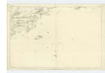
040 | [situation] On the N. [North] side of the Firth of Forth about 3/8 mile South of Barns farm. A sandy bay on the North side of the Firth of Forth. the tide recedes here a considerable distance. there are a few scattered rough rocks situated nearly at low water mark. covered at all tides. there is a small pier here (near the old Church) constructed of loose stones and earth - very little used. |
| BRAEFOOT PLANTATION | Braefoot Plantation Braefoot Plantation Braefoot Plantation Braefoot Plantation |
Property Map Mr. Philips Mr. Smith, Forester Dr. Ralph |
040 | [situation] About 1/2 mile S.E. [Southeast] of St Colme House. A large mixed plantation on an elevation overlooking the sea. on the west side of which is Dalgety Bay - and bounded on the south by a precipitous cliff. |
| BRAEFOOT POINT | Braefoot Point Braefoot Point Braefoot Point Braefoot Point |
Chart of Firth Mr. Philips Mr. Smith Dr. Ralph. Dalgety |
040 | [situation] At the Southern extremity of Braefoot Plantation. A point of land situated at the east side of Dalgety Bay, terminating in low rugged rocks. |
Continued entries/extra info
11 Plan 40A Dalgety ParishTranscribers who have contributed to this page.
MaxInSpain
Location information for this page.
Linked mapsheets.