OS1/15/2/7


| List of names as written | Various modes of spelling | Authorities for spelling | Situation | Description remarks |
|---|---|---|---|---|
| WEST BURN | West Burn West Burn |
George Blair John Rankine |
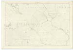
016 | [Situation] At the, E. [East] end of Cracking Shaw A small stream having its rise at the west side of Lamb Hill. and running in a S. [South] Easterly direction to its junction with Tay Burn, from thence called Bothwell Water, |
| CRACKING SHAW | Crackingshaw Crackingshaw Crackingshaw Crackingshaw |
George Blair John Rankine James Davidson Johnston's Map |
016 | [Situation] About 1 Mile W, by N, [West by North] from Friardykes A tract of heathy pasture land, situated a short distance north of Wool Hill. |
| CRACKING SHAW BURN | Crackingshaw Burn Crackingshaw Burn Crackingshaw Burn |
George Blair John Rankine James Davidson |
016 | [Situation] At the S, [South] side of Cracking Shaw A small stream having its rise at the south side of Crackingshaw and running westerly to West Burn, |
Continued entries/extra info
[Page] 7Parish of Stenton (Detached)
[Note] -- "Shaw, a piece of ground which becomes
suddenly flat at the bottom of a
hill. -- Jamieson's Scott: Dict [Scottish Dictionary]
Here the name applies to a Shaw & therefore ought to be written as two words
[Note] -- "Crackingshaw" written in two
words according to the usual mode
adopted on the Scotch places in such cases.
Transcribers who have contributed to this page.
Moira L- Moderator, Douglas Montgomery
Location information for this page.
Linked mapsheets.