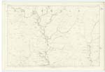
OS1/10/51/4


| List of names as written | Various modes of spelling | Authorities for spelling | Situation | Description remarks |
|---|---|---|---|---|
| GLENDINNING BURN | Glendinning Burn Glendinning Burn |
Thomas Anderson Shepherd Glendinning James Anderson Shepherd Greensykes |
026 | [Situation] Flows ½ mile S.W [South West] of The Leas. A large Stream which gathers between Glendinning Heights and Millers Meadow and flows in a Southerly direction until it joins Meggett Water a short [distance] West of Glendinning. |
| MILLERS MEADOW | Millers Meadow Millers Meadow |
Thomas Anderson Shepherd Glendinning James Anderson Shepherd Greensykes |
026 | [Situation] 25 Chains S.W.[South West] of The Leas. This name applies to a flat piece of land on the farm of Glendinning the surface of which is rough and heathy pastures. The property of Sir Frederick Johnstone of Westerhall |
| GREEN SIKE | Green Syke Green Syke |
Thomas Anderson Shepherd Glendinning James Anderson Shepherd Greensykes |
026 | [Situation] Flows S.E. [South East] of Millers Meadows. A small stream which gathers on Millers Meadow and flows West untill it joins a Burn which runs through Kirk Cleugh. |
| GLENDINNING HEIGHTS | Glendinning Heights | Thomas Anderson Shepherd James Anderson |
026 | [Situation] ½ Mile S.W. [South West] of Millers Meadow. A large heathy ridge Situated on the West of Glendinning Burn. There are several inequalities in this ridge. |
Continued entries/extra info
[Page] 4Parish of Westerkirk -- Sheet 26 No. 4 Trace 3 & 4
Transcribers who have contributed to this page.
Chr1smac -Moderator, DANIALSAN
Location information for this page.
Linked mapsheets.