OS1/10/49/60


| List of names as written | Various modes of spelling | Authorities for spelling | Situation | Description remarks |
|---|---|---|---|---|
| STONEFAULD KNOWES | Stonefauld Knowes Stonefauld Knowes Stonefauld Knowes |
William McCaw William Proudfoot James Ritchie |
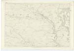
021 | [Situation] 4 1/6 mile NW [North West] from Tynron near the centre of this Parish. A piece of rising ground composed of rock and knolls situated on the North West side of the original farm of Kirkconnel. |
| MAQUESTON BURN | Maqueston Burn Maqueston Burn Maqueston Burn Marqueston or Macqueston Marqueston |
William McCaw William proudfoot James Ritchie Modern Valuation Rolls Johnston's County Map |
021 | [Situation] From near Stonefauld Knowes N.E. [North East] to Shinnel Water. A small Stream that takes its rise near Stonefauld Knowes and flows in a north West direction and falls into the Shinnel Water near to Old Auchenbrack |
Continued entries/extra info
[Page] 60Parish of Tynron -- Plan 21/13 Trace 6
Kirkconnel Hill [crossed out] Cancelled on Trace.
[Signed] James Cowan C/a [Civilian assistant]
Transcribers who have contributed to this page.
CorrieBuidhe- Moderator, Brenda Pollock
Location information for this page.
Linked mapsheets.