OS1/10/28/89


| List of names as written | Various modes of spelling | Authorities for spelling | Situation | Description remarks |
|---|---|---|---|---|
| FORT [Tanners Linn] | British Fort (Camp scored out) (site of) |
John Scott Mollin Alexander Scott Mollin Thomas Waugh Mollinburn Village C Stewart Esq [Esquire] Hillside |
033 | Consists of a ditch, and an embankment on either side, is in the shape of a semicircle, both ends of which closes on the left bank of the Tanners Linn, which in this place is almost inaccessible owing to its steepness. it has the appearance of having been a place of much strength at one time. No traditionary of historical accounts are known about it, further than it is supposed to be of Ancient British origin. |
| MOLLINBURN | Mollinburn | John Scott Mollin Robert Graham Raehills Overseer John McAdam Hartfield J J H Johnstone Esq [Esquire] C Stewart Esq {Esquire] |
033 | A small village consisting of Cot houses, to each of which is attached a portion of garden ground, is situated on Mollin Burn, and exactly twelve miles from Dumfries , near the main road leading to Moffat. John Jane Sapper RE[Royal Rngineers] |
| TANNER'S LINN | Tanners Linn | J J H johnstone Esq [Esquire] Raehills Robert Graham Raehills Overseer John Scott Mollin |
033 | A narrow glen, situated on Whiteknowehead Burn, and near to where it joins Mollin Burn. Its banks are exceedingly steep, and covered with Oak trees of natural growth. |
Continued entries/extra info
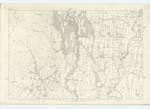
Tanners Linn situation on the Parish BoundaryFort situation 1/3 mile south east from Mollin
Mollinburn situation 55 Chains South East from Mollin
Transcribers who have contributed to this page.
stellas
Location information for this page.
Linked mapsheets.