OS1/2/64/97


| List of names as written | Various modes of spelling | Authorities for spelling | Situation | Description remarks |
|---|---|---|---|---|
| HOUGH SKERRIES | Hough Skerries Hough Skerries Hough Skerries |
Mr. John McLean, Kilmoluag Mr. McLean, Farmer, Greenhill Revd. [Reverend] John G. Campbell, Tiree |
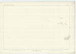
063 | A large and dangerous group of rocks between 1 1/4 and 1 1/2 miles north by east of Craignish Point. Five small points show above high water; the rest are only accessible at spring tides and in calm weather. Situated, in the Parish of Tiree. Property of His Grace the Duke of Argyll. |
| SGEIR A' MHÙSGAIN | Sgeir a' Mhùsgain Sgeir a' Mhùsgain Sgeir a' Mhùsgain |
Mr. John McLean, Kilmoluag Revd. [Reverend] John G. Campbell, Tiree Mr. Alexander McLean, Farmer, Scarnish, Tiree |
063 | A large low water rock, one of the group of Hough Skerries. Meaning "Reef of the Hose-fish" Situated in the Parish of Tiree. |
| SGEIR SHEALG | Sgeir Shealg Sgeir Shealg Sgeir Shealg |
Revd. [Reverend] John G. Campbell, Tiree Mr. Alexander McLean, Farmer, Scarnish Tiree Mr. John McLean Kilmoluag Tiree |
063 | A small group of rocks with two points visible at high water, situated half a mile north west of Hough Skerries. Meaning "Hunting Rock". Situated in the parish of Tiree. Property of His Grace the Duke of Argyll. |
| DUBH SGEIR | Dubh Sgeir Dubh Sgeir Dubh Sgeir |
Revd. [Reverend] John G. Campbell, Tiree Mr. Alexander McLean, Farmer, Scarnish Tiree Mr. John McLean Kilmoluag Tiree |
063 | A small rock in the sea showing a small point at high water and situated 1 1/2 miles west by north of Hough Skerries. Meaning "Black Rock" Situated in the parish of Tiree. Property of His Grace the Duke of Argyll. |
Continued entries/extra info
[Page] 97Sheet 63 -- Island of Tiree. -- Argyllshire
[Signed]
John McKeith
Sapper R.E. [Royal Engineers]
Transcribers who have contributed to this page.
Alison James- Moderator, Eleanor Brown
Location information for this page.
Linked mapsheets.