OS1/35/19/31


| List of names as written | Various modes of spelling | Authorities for spelling | Situation | Description remarks |
|---|---|---|---|---|
| INNERMESSAN | Innermessan Innermessan Innermessan Innermessan Innermesson Inner Massen Inner massen Innermessan |
David Douglas Peter Blane Michael Gray James Drynan Ainslie's map 1782 Admiralty chart 1841 Rl. Engrs. [Royal Engineers] Map 1819 George McHaffie Esqr. |
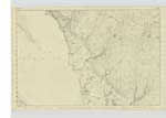
010 | [Situation] In the west side of the parish of Inch adjoining the shore of Loch Ryan This name applies to (about) a dozen of houses forming a Small hamlet or village Considerably Scattered, in it is a grocer's shop a bone & carding mill a Tuck mill a Smithy etc. The land is also called Innermessan at this place or adjoining it was formerly a town called Innermessan and anciently a town of the Romans called Rerigonium a little N.E. [North East] side of Innermessan Moat was discovered from time to time the foundations of buildings from which might be inferred that the modern town of Innermessan (or as some in the vicinity would call it Innerdoge) Stood upon the Rood Farm. There are various traditions in the neighbourhood concerning this place but of little information - for further particulars see Statistical acct. [account] of Scotland also Nicholsons Hist. [History] of Galloway |
Continued entries/extra info
[Page] 31 -- Parish of InchTranscribers who have contributed to this page.
Chr1smac -Moderator
Location information for this page.
Linked mapsheets.