OS1/35/75/13


| List of names as written | Various modes of spelling | Authorities for spelling | Situation | Description remarks |
|---|---|---|---|---|
| LANDBERRICK | Landberrick Landberrick Landberrick Landberrick Landberrick Landberrick |
James McMaster. William McMaster. Proprietor's Rent Roll. Ainslie's Map 1782. Royal Engineers Map 1819. George McHaffie, Esq. [Esquire]. |
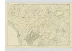
029 | A long tract of land divided into several small farms, and each of them with a good farm house & the largest of which is occupied by James McMaster. This district of land is bounded on the North by the farm of Airyhassen, on the East by Drumtroddan and on the West by Glentriplock & Killantrae. The property of Sir William Maxwell. About 2 miles NE of Port William. |
| LANDBERRICK HILL | Landberrick Hill Landberrick Hill Landberrick Hill |
James McMaster. William McMaster. George McHaffie, Esq. [Esquire] |
029 | A long hill on the farm of Landberrick (hence its name), the soil of which is arable land. The property of Sir William Maxwell. About 1 3/4 miles NE of Port William. |
| WOOD HILL | 029 | |||
| Landberrick Hill Landberrick Hill Landberrick Hill |
James McMaster. William McMaster. George McHaffie, Esq. [Esquire] |
A long hill on the farm of Landberrick (hence its name), the soil of which is arable land. The property of Sir William Maxwell. About 1 3/4 miles NE of Port William. |
Transcriber's notes
This page was partially transcribed, however while saving a transcription, an error message appeared and the entire page is no longer available.Transcribers who have contributed to this page.
Muriel Rousay
Location information for this page.
Linked mapsheets.