OS1/35/73/16


| List of names as written | Various modes of spelling | Authorities for spelling | Situation | Description remarks |
|---|---|---|---|---|
| CORNHULLOCH | Cornhulloch Cornhulloch Cornhulloch Curhulloch Curhulloch . Cornhulloch . Cornhullick Cornhullock |
John Anderson John Biggam Alexander Rowan John Hannay James Cumming Esq. Airloch Port William Rl. Engrs. [Royal Engineers] Map 1819. Ainslies Map 1782. George McHaffie Esq. |
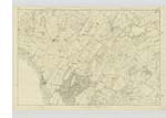
029 | [Situation] About 1/2 mile East of Kirk of Mochrum. A considerable tract of land formerly one farm but is now divided into three farms and are respectively Occupied by John Anderson, John Hannay, etc. The property of Sir William Maxwell. This tract of land is bounded on the South by Little Killantrae, on the East by Clone and the West by East Barr. Situate to the South is a Trigl. [Trigonometrical] Party "Clone" |
| CORNHULLOCH Hill | Cornhulloch Hill Cornhulloch Hill Cornhulloch Hill |
John Anderson John Biggam George McHaffie Esq. |
029 | [Situation] 5/8 mile W N W [West North West] of Kirk of Mochrum A large hill on the lands of Cornhulloch the Soil of which is arable land. |
Continued entries/extra info
[Page] 16[Parish] of Mochrum
Form 136
Page 50- Cornhulloch
51- Cornhulloch Hill
Transcribers who have contributed to this page.
Chr1smac -Moderator, Muriel Rousay
Location information for this page.
Linked mapsheets.