OS1/35/73/11


| List of names as written | Various modes of spelling | Authorities for spelling | Situation | Description remarks |
|---|---|---|---|---|
| CARSDUCHAN MOOR PLANTATION | Carsduchan Moor Plantating Carsduchan Moor Plantating Carsduchan Moor Plantating Carsduchan Moor Plantating |
Archibald Bride . Charles Coid . Name List Plan 25D . George McHaffie Esqr. |
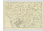
029 | [Situation] About 1 7/8 miles N E. by N. [North East by North] of Kirk of Mochrum A considerable tract of Plantation on the lands of Carsduchan the wood of which consists of Fir & oak. Situate on the North side of Carsduchan land from which it takes it name. on the N. W.[North West] Side is a Trigl. [Trigonometrical] Station called by Trigl. [Trigonometrical] Party "Skaithmoor" |
| CARSDUCHAN | Carsduchan Carsduchan Carsduchan . . Carsdouchan Carsdouchan . Carsduchan |
Archibald Bride. Charles Coid. Royal Engrs. [Engineers] Map 1819. Ainslies Map 1782. Genl. [General] Map of Scotland. George McHaffie Esqr. |
029 | [Situation] About 1 1/2 miles NE [North east] of Kirk of Mochrum. A large tract of land formerly one farm, but is now divided into 7 or 8 small holdings or farms, the largest of which consists of 170 acres, and is occupied by Archibald Bride. The property of Sir William Maxwell. On these lands is a Trigl. [Trigonometrical] Station called by Trigl. [Trigonometrical] Party 'Carsaduchan'. |
Continued entries/extra info
1st. page of Trace 3. Plan 29A[Page] 11 Parish of Mochrum
Form 136
Page 47 - Carsduchan Moor Plantation
47 - Carsduchan
Transcribers who have contributed to this page.
Chr1smac -Moderator, Muriel Rousay
Location information for this page.
Linked mapsheets.