OS1/35/67/14


| List of names as written | Various modes of spelling | Authorities for spelling | Situation | Description remarks |
|---|---|---|---|---|
| TURKEY HILL | Turkey Hill | Mr. J. Broadfoot Mr. J. McClelland |
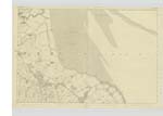
026 | [Situation] On the farm of 'Balfern' (N) [North] S by W [South by West] of 'Ring Hill'. 1 mile S E [South East] of Kirkinner. A prominent hill on the farm of '[Balfern]' (North) on its summit is a Trigl. [Trigonometrical] Station called after the hill by the Trigl. [Trigonometrical] Party. |
| BALDOON PARKS | Baldoon Parks Baldoon Parks Baldoon Parks |
Mr. J. Broadfoot "Map of Galloway" Nicholsons His [History] of Galloway. Ainslie's Map 1782. |
026 | [Situation] On the Farms of 'Baldoon Mains'. 'West Mains', 'East Mains' & 'Crook' bounded on the north by 'River Bladnoch' & on the South by the farms of 'West Mains' & Kirkland - "East Mains" & 'Balfern' (North). A large district of Country, [forming] a green Park on the Estate of 'Baldoon' but now divided [into] farms. |
Continued entries/extra info
[Page] 14- Plan 26 A -- Parish of KirkinnerForm 136
Page 29- Turkey Hill
34 - Baldoon Parks
Transcribers who have contributed to this page.
Chr1smac -Moderator, Muriel Rousay
Location information for this page.
Linked mapsheets.