OS1/35/58/7


| List of names as written | Various modes of spelling | Authorities for spelling | Situation | Description remarks |
|---|---|---|---|---|
| RINGDOO POINT | Ringdoo Point Ringdoo Point |
William Thorburn Mr. Robert McKenzie George McHaffie Esqr. |
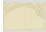
023 | [Situation] - In the N.W. [North West] of the Ph. [Parish] of Old Luce about 90 yrs North of high water mark - A point of land on which stands a trigl. [trigonometrical] station. Joining Luce Bay it consists chiefly of large sand hills which abound plentifully of rabbits. |
| WHITECROOK | White Crook Whitecrook Whitecrook |
William Thorburn Johnsons Map of Wigtonshire Ainslie's Map 1782 |
023 | In the S.W. [South West] of the Ph. [Parish] of Old Luce North side of Pooltanton Burn - A trigl [trigonometrical] station named after the farm (White Crook) on which it stands. |
| DEVIL'S MEAL CHEST | Ring- doo or the Devil's meal chest Devils Meal Chest Devils Meal Chest Devils Meal Chest |
John Mortrie William Hyslop John Guffy |
023 | [Situation] - In the S.W. [South West] of the Ph. [Parish] of Old Luce about 200 yds North of high water mark - A large sand hill in the farm of Low Torrs on which is a trigl [trigonometrical ] station It is so called from the great mass of sand comprising the hill. |
Continued entries/extra info
[Page] 7 -Parish of Old LuceForm 136
Page -- 15- Ringdoo Point
15 - White Crook
15- Ringdoo or the Devil's meal chest
Transcribers who have contributed to this page.
Chr1smac -Moderator
Location information for this page.
Linked mapsheets.