OS1/35/47/79


| List of names as written | Various modes of spelling | Authorities for spelling | Situation | Description remarks |
|---|---|---|---|---|
| HIGH MOOR OF KILLIEMORE | High Moor of Killiemore | John McLelland Water Side (via) Kirkcowan Alexander Burnie, Barskeagh (via) Kirkcowan Alexander Couperthwait, Killiemore |
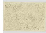
019 | A large tract of Land part Moorland and part arable with Several Small Stone built houses and thatched with Small pieces of Land attached to each it had been an uncultivated moor previous to the proprietor letting in Small portions it now very cultivated. It is Situated 3 miles SE [South East] of Kirkcowan Villiage and is bounded on the West by Killiemore farm, on the South by Kirkchrist, Middle & High Threaves on the E [East] and NE [North East] by Baravnnon and Barraer Farms and on the North by Low Glasnoch. It is the property of Mr Ivy Campbell of Old Cumnock. on the most prominent there Stands a Trigl [Trigonometrical] Station called Killimore |
Continued entries/extra info
[Page] 79Plan 19 A -- List of Names collected by Private Peter Bracken
Trace 2 -- [Parish] Penninghame
[Object]
High Moot of Killiemore -- Tract of Land
[Signed] Peter Bracken
Pt. [Private] RS&M [Royal Sappers & Miners]
July 6th /47 [1847]
Transcribers who have contributed to this page.
Chr1smac -Moderator, JCB
Location information for this page.
Linked mapsheets.