OS1/35/47/30


| List of names as written | Various modes of spelling | Authorities for spelling | Situation | Description remarks |
|---|---|---|---|---|
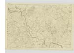
| KNOCKCUDDIE | KnocKcuddie | See Name List Plan 19B- | 019 | [Situation] 3 Mile E. [East] by South of KirKcowan For description See Name List Plan 19B. |
| BAR FAULDS | Bar Faulds | See Name List Plan 19B- | 019 | [Situation] 2 3/4 Miles East of Kirkcowan For description See Name List Plan 19B |
| BARRAER FELL | Barraer Fell Barraer Fell Fell of Barrawr Baraer fell Fell of Barrawer |
John Kevan George McHaffie Ainslies map 1782. Alexander Mc Clymont Royl. Engrs. [Royal Engineers ] map 1819. |
019 | [Situation] 3 Miles East by North of Kirkcowan A Steep and rocky hill at the Southern end of the flow of Barnen, on the farm of Barraer. |
Continued entries/extra info
[Page] 30 -- Parish of PenninghameTranscribers who have contributed to this page.
Chr1smac -Moderator, joseph mc keown
Location information for this page.
Linked mapsheets.