OS1/35/46/13


| List of names as written | Various modes of spelling | Authorities for spelling | Situation | Description remarks |
|---|---|---|---|---|
| MINDORK MOSS | Mandork Moss Mandork Moss Mindork Mindork Mindork Mindork Mindork |
John McKie David Lauderdale Royl. Engrs. [Royal Engineers] map 1819 Ainslies map 1782 See Name List 19A map of property 1790 George McHaffie Esqr. |
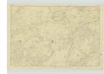
018 | [Situation] In the SW [South West] angle of the Parish. A large tract of Moss Situate of the South Side of High and Low Mandork It is interspersed with portions of rocky ground it is bounded on the South Side by the Parish boundary |
| DRUMWHILLAN | Drumwhillan Drumwhillan Drumwhillan |
John Mckie David Lauderdale George McHaffie Esqr. |
018 | [Situation] North of Mindork Moss. A considerable hill the Surface of which is arable Situate on the farm of High Mandork. On its Summit is a Trigl. [Trigonometrical] Station. |
| DRUMMONNIE | Drummoney Drummonie Drummonnie |
John McKie David Lauderdale George McHaffie Esqr. |
018 | [Situation] North of Mindork Moss. A Small arable hill at the north Side of Mandork Moss on the farm of Low Mandork |
Continued entries/extra info
[Page] 13Parish of Kirkcowan
[Form 136] Page
37 -- Mindork Moss
35 -- Drumwhillan
35 -- Drummonnie
Moine dorch (Gaelic) The black or dark coloured bog
Druin The ridge of a hill etc
Guallann A mountain projection
Druim moine The bog hill or ridge
Transcribers who have contributed to this page.
Chr1smac -Moderator, JCB
Location information for this page.
Linked mapsheets.