OS1/35/45/5


| List of names as written | Various modes of spelling | Authorities for spelling | Situation | Description remarks |
|---|---|---|---|---|
| FLOW OF DERGOALS | Flow of Dargoals Flow of Dargoals Flow of Dargoals Flow of Dergoals Dargoals Dargoles Flow of Dergoals |
Robert McGill Andrew Shearer Thomas Murchie John Dugan Ordnance Map 1819 Ainslie's Map 1782 George Guthrie Esqr. |
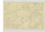
018 | [Situation] 1½ Miles West of Dernaglar Loch A large tract of Moss situated on the South side of the road leading from Glenluce to Newtonstewart It is for the greater part soft and wet It extends from Wood of Dirvaird to Drumcarrick Hill It belongs in part to each of three farms Wood of Dirvaird, Dirvaird, and Dargoals. |
| DARVAIRD LOCH | Dirvaird Loch Dirvaird Loch Dirvaird Loch Dervaird Loch Darvaird Darvaird |
Robert McGill Andrew Shearer Thomas Murchie John Dugan Ordnance Map 1819 See Name List Plan 17D |
018 | [Situation] 2 Miles West of Dernaglar Loch. A small natural Loch situated on the farm of Wood of Dirvaird. |
Continued entries/extra info
[Page] 5Parish of Old Luce
Form 136 Page
21 Flow of Dergoals
21 Darvaird Loch
2Dair" - an oak
"Gobhal" - The forked part of anything
i.e. The Forked oak. Gaelic Dictionary
Transcribers who have contributed to this page.
Chr1smac -Moderator, DANIALSAN
Location information for this page.
Linked mapsheets.