OS1/35/45/3


| List of names as written | Various modes of spelling | Authorities for spelling | Situation | Description remarks |
|---|---|---|---|---|
| BLACK HILL | Black Hill Black Hill |
James Cairns Robert McGill |
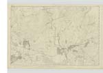
017 | [Situation] 2 Mile West of Dernagler Loch. A moderate Sized hill adjoining the N.W. [North West] of the road leading from Glen Luce to Newtonstewart the soil is arable and tolerably good, on the Summit is a Trigl. [Trigonometrical] Station. |
| WOOD OF DARVAIRD | Wood of Dirvaird Wood of Dirvaird Wood Wood of Dirvaird Wood of Dervaird Wood Darvaird |
William Kerr Map of Wigtownshire 1782 William J. Saunders James Gibson Esqr. John Dugan Ordnance Map 1819 See Name List Plan 17D |
017 | [Situation] 2 Mile West by South of Dernaglar Loch. An ordinary farm house and outbuildings with a farm attached consisting of 250 acres of land 2/3 of which is moorland or rocKy heathy pasture a small portion is arable the remainder peat moss or bog. occupied by William Kerr The property of Sir James D Hay Bart. [Baronet] near the farm house is a Trigl. [Trigonometrical] Station called after the farm. |
Continued entries/extra info
[Page] 318C Parish of Old Luce
Form 136 Page
19 Black Hill
19 Wood of Darvaird
"Dair" - Oak
"Darach" Oak, Timber
"Airde" - Height, eminence etc Gaelic Dictionary
Transcribers who have contributed to this page.
Chr1smac -Moderator, DANIALSAN
Location information for this page.
Linked mapsheets.