OS1/35/35/8


| List of names as written | Various modes of spelling | Authorities for spelling | Situation | Description remarks |
|---|---|---|---|---|
| SHEUCHAN MILL (Corn) | Sheuchan Mill Sheuchan Mill Sheuchan Mill Shewchan Mill |
John Adair John McFadden James Douglas Ainslie's Map 1782 |
016 | [Situation] About 5/8 mile N.W. [North West] from the Ph. [Parish] Church of Stranraer A large corn Mill and a farina Mill worked by waterwheel and by steam engine the property of McEwen and co. [Company] here is also a manufactory or worKshop for maKing [Carriages] (Gigs spring cars etc.) also Carts ploughs & other farming implements [Ships] building is occasionally done to the worKs belonging to James Douglas here are also [4 to] 5 dwelling houses the whole is well Known [by] the name "Sheuchan Mill" |
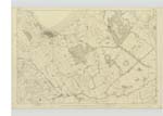
| LOCH RYAN | Loch Ryan Bay of Loch Ryan Bay of Loch Ryan Loch Ryan Loch Ryan |
Maps of Property 1828 Map of property 1795 Statisl. acct [Statistical account] of Scotland 1839 Ainslie's Map 1782 Rl. Engr. [Royal Engineers] Map 1819 See Plans 5A & 10 A |
016 | [Situation] In the N.W. [North West] part of the County of Wigtown "Lochryan is situated at what may be Considered the entrance of the Firth of Clyde being about 60 Miles South west of Greenock 40 miles South South East Campbelltown 52 miles Southeast of the of the north channel opening into the western ocean and 40 miles north [east] of the entrance of Belfast Loch . At its entrance it is about 3 miles across from [east] to west with from 4 to 5 fathoms of water which gradually deepens to 7 or 8 as you [proceed ] up . The Loch lies North and South And is between [8] & 9 miles long from the entrance to the town of Stranraer Situated at the head of it. Its breadth varies from 2 to 5 miles The above description which I consider correct is taken from the Statisl [Statistical account] of Scotland No. [Number] 21 Page 81 Published 1839 |
Continued entries/extra info
[Page] 8-- Parish of LeswaltForm 136
Page - 87, 90 - Sheuchan Mill
- 91 - Loch Ryan
Transcribers who have contributed to this page.
Chr1smac -Moderator
Location information for this page.
Linked mapsheets.