OS1/35/35/69


| List of names as written | Various modes of spelling | Authorities for spelling | Situation | Description remarks |
|---|---|---|---|---|
| BRIDGE OF AIRD | Bridge of Aird Bridge of Aird Aird Bridge |
John Crawford James Crawford Rl. Engrs. [Royal Rngineers] Map 1819 |
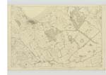
016 | [Situation] About 7/8 mile E by S [East by South] from North West Castle A Small farm house and out offices in middling repair Slated and a farm attached of about 80 acres of arable land at the yearly rent of £48 occupied by William McDowal the property of the Earl of Stair |
| AIRD MOSS | Aird Moss Aird Moss Aird Moss |
Mr. J. Galbraith Rl. Engrs [Royal Engineers] Map 1819 John Crawford |
016 | [Situation] About1 1/4 miles E by S [East by South] from North West Castle A tract of moss on the lands of Aird which is now in progress of being reclaimed this moss was formerly much more extensive than at present but was reclaimed from time to time near the SE [South east] side of this moss is a Trigl [Trigonometrical] Station Called " Ard North" by Trigl [Trigonometrical] Party it being on the lands of Aird |
| BISHOP BURN BRIDGE | Bishop Burn Bridge Bishop Burn Bridge |
James Stewart John Crawford |
016 | [Situation] About 7/8 mile NE by E [North East by East] from North West Castle A Stone bridge of one arch built in 1843 over the Bishop Burn on the road from Stranraer to Cairn Ryan [to] Glasgow - near the East side of this bridge is a Trigl. [Trigonometrical] Station Called by the Trigl. [Trigonometrical] Party "Sand Mill Hill" it being on a farm of that name Sand Mill. It is a County Bridge |
Continued entries/extra info
Parish of Inch -- [Page] 69Form 136
Page - 205- Bridge of Aird
207- Aird Moss
206 - Bishop Burn Bridge
Transcribers who have contributed to this page.
Chr1smac -Moderator
Location information for this page.
Linked mapsheets.