OS1/35/35/13


| List of names as written | Various modes of spelling | Authorities for spelling | Situation | Description remarks |
|---|---|---|---|---|
| DRUM HILL | Drum Hill Drum Hill Drum Hill |
William McKissacK map of property 1828 John McFaden |
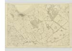
016 | [Situation] Near the north Side of Peter's Hill A moderate Sized hill on the farm of MeiKle MarK the base of it is of an oval Shape. The Soil is arable |
| PARK HEAD | ParK Head ParK head ParKhead |
Map of property 1828 John McFadden Ainslie's Map 1782 |
016 | [Situation] 1 1/2 miles East from the Parish Church of Stranraer A tract of land consisting of About 60 acres Occupied by William McKissacK in connection with the farm of MeiKle MarK . This tract was formerly occupied as a separate farm |
| COLD WELL | Cold Well Cold Well Cold well Cold Spring |
Map of property 1828 W.C.Chhristison John McFadden Rl. Engrs. [Royal Engineers] Map 1819 |
016 | [Situation] About 1 1/8 miles WSW [West South West] from the Ph. Parish Church Stranraer A good Spring well in the farm of SpringbanK it does not fail in the driest Seasons |
Continued entries/extra info
[Page] 13 -- Parish of LeswaltForm 136
Page - 97 Drum Hill - "Druim" - ridge of a hill - Gaelic Dictionary
101- ParK Head
101-Cold Well - 3 Authorities for Well , 1 Authority for Spring
Transcribers who have contributed to this page.
Chr1smac -Moderator
Location information for this page.
Linked mapsheets.