OS1/35/33/23


| List of names as written | Various modes of spelling | Authorities for spelling | Situation | Description remarks |
|---|---|---|---|---|
| DINDINNIE BURN | Dendennie Burn Dendennie Burn Dindinnie |
Robert McNillie Charles McNillie George McHaffie Esqr. Factor to the Estate |
015 | [Situation] Running in a North Easterly direction passing at the South side of East Dindinnie (farm house) A Stream or burn rising north of Slewscinnie Hill and running through the farm of Dendennie runs into Poltanton Burn near the farm of East Dendennie |
| TUN HILL | Tun Hill Tun Hill |
Robert McNillie Charles McNillie |
015 | [Situation] 1 1/8 mile S.E. [South East] off Low Glenstockadale A high hill on the lands of Dendennie the Surface of which is good pasture land. On it is a Trigl. [Trigonometrical] Station called by Trigl. [Trigonometrical] Party "Dendennie" |
| MOAT HILL | Moat Hill Moat Hill |
Robert McNillie Charles McNillie |
015 | [Situation] 1 mile SE by E [South East by East] off Low Glenstockadale & adjoining Tun Hill on the North side A hill on the farm of East Dendennie on the S.W. [South West] Side of the hill is an abrupt rising point or knoll from which it is said the name Moat Hill has arisen |
Continued entries/extra info
[Page] 23Parish of Leswalt
Form 136
Page 69 - Dindinnie Burn
69- Tun Hill
71 - Moat Hill
Transcribers who have contributed to this page.
Chr1smac -Moderator, Brenda Pollock
Location information for this page.
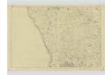
Linked mapsheets.