OS1/35/20/3


| List of names as written | Various modes of spelling | Authorities for spelling | Situation | Description remarks |
|---|---|---|---|---|
| FELL OF CRAIGCAFFIE | Fell of Craigcaffie Fell of Craigcaffie Fell of Craigcaffie Fell of Craigcaffie Craigcaffie Craigcaffie Fell of Craigcaffie |
Thomas Wallace Hugh Graham David Garrett W. Stewart Rl. Engrs [Royal Engineers] Map 1819 Ainslie's Map 1782 Statistical Acct. [Account] 1841 George McHaffie Esqr. |
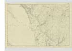
010 | [Situation] On the west side of the Parish & 1 1/2 Miles north of Black Loch This name applies to a prominent part of a range of hills of a considerable length & consists chiefly of rocky moorland ground on the western side of it forms a steep declivity but on the east it beocmes level or flat on the Summit is a Trigl. [Trigonometrical] Station named "Craigcoffey" by trig [trigonometrical] Party |
| KIRCLACHIE BURN | Kirclachie Burn Kirclachie Burn Kirclachie Burn Kirclachie Burn Kirclachie Burn |
John McBride David Garrett Thomas Wallace Hugh Graham George McHaffie Esqr. |
010 | [Situation] 1 Mile North of Black Loch A Stream or burn running in South westerly direction passing SE [South East] side of Fell of Craigcaffie and forming for some distance the boundary btween the farms of Balker and Craigcaffie and flows into the water called the Canal in dry Seasons this stream has scarcely any water but during rainy weather the current is strong |
Continued entries/extra info
[page] 310 D -- Parish of Inch
Form 136
Page 19-- Fell of Craigcaffie
25- Kirclachie Burn
[Note arrowed from George McHaffie] " The same authority gives it Kirlachie Burn N.B. of Plan 10 C Page 28"
Transcribers who have contributed to this page.
Chr1smac -Moderator, hastingleigh
Location information for this page.
Linked mapsheets.