OS1/35/18/27


| List of names as written | Various modes of spelling | Authorities for spelling | Situation | Description remarks |
|---|---|---|---|---|
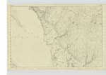
| CRAIG COFFEY | Craig Coffey | Comd [Commander] C.G. Robinson Chart of Loch Ryan 1839 | 010 | A high hill. Extending N. [North] & South from Trigl. ◬'s [Trigonometrical Stations] The East face thereof being Steep and Rocky This is a Small portion of the farm of Craig Coffey the property of the Erel of Stair. |
Continued entries/extra info
Plan 10B Trace 3 -- [Page] 27 -- List of Names collected by William BirKby Pt. RS [Private Royal Sappers] & Miners 1st Examiner -- Parish of InchObject - Craig Coffey - Hill
[Signed] William Birkby
Pt. R S [Private Royal Sappers] & Miners
9th. March 1846
Transcribers who have contributed to this page.
Chr1smac -Moderator
Location information for this page.
Linked mapsheets.