OS1/35/4/13


| List of names as written | Various modes of spelling | Authorities for spelling | Situation | Description remarks |
|---|---|---|---|---|
| CAIRN HILL | Cairn Hill Cairn Hill |
Gilbert Ross Mrs Murray |
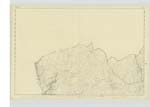
005 | [Situation] In the North part of the Parish & 3/4 Mile N.E. [North East] of Loch Ree, A Small heathy hill East of and adjoining Brochloch Fell. |
| DRUMORAWHIRN BURN or COLDWELLS BURN | Drumawhirn Burn Drumorawhirn Burn Drumorawhirn Burn Drumorawhirn Burn |
Gilbert Ross Ainslie's Map 1782 Ordnance Map 1819 John McGill |
005 | [Situation] - The Northern Boundary of the Parish A Small Stream forming part of the boundary between the Counties of Wigtown and Ayr and joining Penwhirn Burn at the Base of Cairn Hill . |
| PEAT HILL | Peat Hill Peat Hill Peat Hill |
Mrs Murray George McHaffie Esqr. John McGill |
005 | [Situation] 1/2 Mile east of Loch Ree A small heathy hill about 5 Chains N.W. [North West] of BrocKloch Old farm House. |
Continued entries/extra info
Parish of Inch - [Page] 13Form 136
Page
- 41- Cairn Hill
- 41 - Drumawhirn
- 47 - Peat Hill
[Coldwell's Burn] "By order of the D.G. [Director General]"
in C/C 2028/ 87 - John Stirton 28.6.87
Transcribers who have contributed to this page.
DANIALSAN, Chr1smac -Moderator
Location information for this page.
Linked mapsheets.