OS1/35/2/8


| List of names as written | Various modes of spelling | Authorities for spelling | Situation | Description remarks |
|---|---|---|---|---|
| BLOODY ROCK | Bloody Rock Bloody Rock Bloody Rock |
James Osborne John McCamon George McHaffie Esqr. |
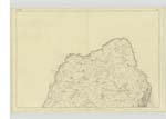
004 | [Situation] On the Shore S.W. [South West] side of Illan-na-guy nearly ¾ mile S.W. [South West] of Corsewall Lighthouse A Small rock projecting a little into the Sea south of Emers Isle. The name is tolerably well Known though an insignificant [object] |
| BLOODY SLOUCH | Bloody Slock Bloody Slock Bloody Slouch |
James McCamon James Osborne George McHaffie Esqr. |
004 | [Situation] On the South side of Bloody Rock ¾ mile S.W. [South West] of Corsewall Lighthouse This name applies to a creek or inlet of the sea on the farm of [Baron]-hill about ½ mile south of Corswall Lighthouse the coast here tho low is very rough The name is said to arise from the circumstance the farmers bleeding their cattle [in] this place |
| THE OX ROCKS | Ox Rocks Owse Ouse Rocks Owse The Ox The Ox The Ox Rocks |
John Knox John Cockrane James Osborne James Kennedy Ainslie's Map 1782 Rl. Engrs [Royal Engineers] Map 1819 George McHaffie Esqr. |
004 | [Situation] ¼ mile N.W. [North West] of Barrack Point & ⅞ mile SW. [South West] of Corsewall Lighthouse, about 15 chains from the Shore Two rocks or small rocky [islets] in the sea a short distance from shore near Barrock Point on of which is a Trigl [Trigonometrical] Station Called by Trigl [Trigonometrical] Party Orrest Rock |
Continued entries/extra info
[Page] 8Parish of Kirkcolm
Form 136
Page 61 - Bloody RocK
63- Bloody Slouch
66- Ox Rocks
"Slouch" A deep ravine, a gully.
Dr [Doctor] Jamieson's Dictionary
Transcribers who have contributed to this page.
Chr1smac -Moderator, Missus SW
Location information for this page.
Linked mapsheets.