OS1/32/7/83


| List of names as written | Various modes of spelling | Authorities for spelling | Situation | Description remarks |
|---|---|---|---|---|
| Cockle Cairn | Cockle Cairn Cockle Cairn Cockle Cairn |
D. Foyers Knowehead R Kincaid Bencloich Mains D. Campbell Garmore |
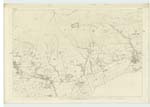
028 | A Stone cairn on the Boundary of the Parish adjoining Kilsyth The name is well known |
| Sloughmuclock | Sloughmuclock Sloughmuclock Sloughmuclock |
Estate Map J Begg Factor R. Kincaid |
028.05 | A rocky gully on the steep face of the range of the Campsie Fells which extend from the "Craw Road" in the west to "Brown Hill" adjoining the Kilsyth Hills in the east. To the east of the gully there are three tiers of steep rock each about 20 feet from the top to the bottom, but they are not quite so regular on the west side of the gully. Loose detached pieces of rock lie between "Sloughmuclock" and the bottom of the Fells. This name is very well known. |
Continued entries/extra info
[Page] 83Co. [County] Stirling -- Campsie Parish
[Note below Sloughmuclock:]
not on Plan
Transcribers who have contributed to this page.
Alison James- Moderator, Rmgt
Location information for this page.
Linked mapsheets.