OS1/32/6/53


| List of names as written | Various modes of spelling | Authorities for spelling | Situation | Description remarks |
|---|---|---|---|---|
| Ben Lomond | Ben Lomond Ben Lomond Ben Lomond Ben Lomond Ben Lomond Ben Lomond |
Old Statistical Account County Maps Tourists' Guide Mr. A Blair Rowardennan Mr. D. Mitchell Blairvockie W. Jolly Esq. Factor |
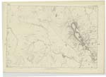
004 | "The highest hill in this part of the Country is Ben Lomond which is about 1080 yards above sea level. Ben Lomond signifies the "bare green hill". Old Statistical Account. There is no regular flat on the top of Ben Lomond, as from the edge of the precipice forming the southern enclosure of "Coire Bathaich" the descent begins on both sides. The foot track, as shown on Examination Trace, is the evenest part, excepting the Trigl. [Trigonometrical] Pole, at which it averages about 70 links for a short distance east and west. The fall on the north side is a mass of loose broken rocks with some small outcroppings of rock scattered or appearing as represented. "Coire Bathaich" signifying the Byre or Cowhouse Corrie, is very steep and forms on the south side the top of the hill. There is a good foot road [continued on page 54] |
Continued entries/extra info
[Page] 53Co. [County] Stirling -- Buchanan Parish
Transcribers who have contributed to this page.
Alison James- Moderator, l10hoy
Location information for this page.