OS1/30/14/26


| List of names as written | Various modes of spelling | Authorities for spelling | Situation | Description remarks |
|---|---|---|---|---|
| Whitehope Rig | Whitehope Rig Whitehope Rig Whitehope Rig |
John Brockie John Laidlaw Walter Laidlaw |
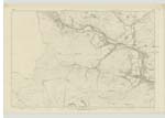
007 | A hill on the farm of Lewenshope, and situated between Gauntly burn and C [Cameron] burn; it is covered with rough heathy pasture. |
| Cameron Burn | Cameron Burn Cameron Burn Cameron Burn |
John Laidlaw John Brockie Walter Laidlaw |
007 | A small stream rising near the head [of] Permanscore, and flowing southward for about three quarters of a mile, when it joins Gauntly burn; for some part of its course, it divides the parishes of Yarrow and Selkirk. |
| Four Lords Lands | Four Lords Lands Four Lords Lands Four Lords Lands |
John Laidlaw John Brockie County Map |
007 | A spot near the head of Permanscore where the lands of four proprietors join; [?] His Grace, the Duke of Buccleuch, Mitchell Innes Esqr of Stow, James Johnston Esqr of Hangingshaw, and Robert Keith [Pringle] Esqr of Broadmeadows. |
Continued entries/extra info
[Page] 26Parish of Yarrow
Sheet 7 Traces 4 & 5
Described by Sapper Montgomery RE [Royal Engineers]
Transcriber's notes
The name Robert Keith Pringle determined from OS1/30/10/65Transcribers who have contributed to this page.
Skinnb1- Moderator, Soutar99
Location information for this page.
Linked mapsheets.