OS1/29/8/1


| List of names as written | Various modes of spelling | Authorities for spelling | Situation | Description remarks |
|---|---|---|---|---|
| CAVERS | Cavers | Johnston's Map of Roxburghshire Blackwood's Map of Roxburghshire New Statistical Acct [Account] of Roxburgh |
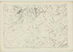
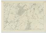
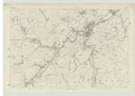
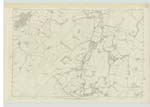
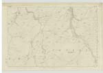
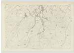
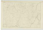
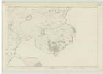
019; 020; 025; 026; 032; 033; 038 | [Situation] In the Southern division of the County of Roxburgh -- The name of this Parish is said to be derived from Cambro-British Cae and Ber signifying short field or enclosure, notwithstanding that the openness and extent of the Parish as it now exists would seem to render the appellation most inapplicable. The Parish of Cavers is bounded on the North by those of Minto and Bedrule, on the East by Bedrule and Hobkirk, on the South by Castleton and on the West by Kirkton Teviothead, Hawick and Wilton. It was formerly divided near its centre by the Parishes of Kirkton and Hobkirk, but the two divisions are now united by a narrow strip detached respectively from these two Parishes. There is no detached portion of another Ph [Parish] situate within the limits here assigned to Cavers, nor is there a detached part of that Ph [Parish] within the Bdry [Boundary] of any other. Of irregular form - it contains about 18,353 Impl. [Imperial] Acres. The western district is hilly and rugged but towards the East it becomes flat with a rich fertile soil - the southern division is mountainous. Most of the hills are detached and present a conical appearance, though those at the Southern extremity also remarkable for their distinct and rotund shape - are for the most part interwoven with each other |
Continued entries/extra info
[Page] 1Parish of Cavers County of Roxburghshire
Transcribers who have contributed to this page.
Skinnb1- Moderator, Moira L- Moderator, rankin
Location information for this page.
Linked mapsheets.