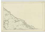
OS1/27/1/9
| List of names as written | Various modes of spelling | Authorities for spelling | Situation | Description remarks |
|---|---|---|---|---|
| AIRD DHAIL | Aird Dell Aird Dell Aird Dell |
John Morrison John McKay Allan Ross |
002 | [Situation] On the sea coast in the N.W. [North West] section of the plan, 60 chains W.N.W.[West North West] of Dail O Dheas A large bold and prominent headland, which is one of the most remarkable between Butt of Lewis and Ard Bhragair. Its surface is partly arable and partly moor pasture and has four or five huts on its Northern end. Its coast is bold and rugged and its beach very narrow. Signifies Dell Headland. |
| AIRD DELL | Col. [Colonel] J. Farquharson C.B R.E. [Royal Engineers] Genl. [General] Ordnance Survey. Mr. J. Mathieson O.S.O. [Ordnance Survey Office] Edinburgh |
|||
| DÙNASBROC | Dùnasbroc Dùnasbroc Dùnasbroc |
John Morrison John McKay Allan Ross |
002 | [Situation] On the sea shore in the N.W. [North West] section of the plan, 20 chains W.N.W. [West North West] of Dail O Dheas. A steep rocky cliff on the Sea Coast, at the Western side of Aird Dhail. It is about twenty chains long, and the Sea beats against it with great force. |
Continued entries/extra info
[Page] 9Parish of Barvas
2D
Transcribers who have contributed to this page.
DANIALSAN, Bizzy- Moderator, eilthireach
Location information for this page.


