OS1/25/42/10


| List of names as written | Various modes of spelling | Authorities for spelling | Situation | Description remarks |
|---|---|---|---|---|
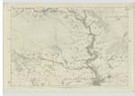
| Supposed Site of the BATTLE OF MONS GRAMPIUS | Supposed Site of the BATTLE OF MONS GRAMPIUS between the Britons under Galgacus and the Romans under Agricola A.D. 84 | 052 | "The word Stour signifying a fight or battle, that name seems rather to have arisen from the Stormont having been the field of battle between Agricola and Galgacus in the 84th. year of the Christain era. Of this battle, there are traces at Mause &c. Tacitus, in the life of Agricola says that Agricola arrived at mount Grampius where the Britons had already sat down; which must be some place on the side of the Grampian Mountains where they rise from Strathmore. That it was beyond the estuary of the Tay, may be meant by the words of Agricola on the occasion, "transisse aestuaria" It was within the province of the Horesti, the boundary or "finis" of which extended to the shore & the fleet ("deduxit exercitum in fines Horestorum;") from which he returned again through the territory of the newly conquered people; this cannot accord with any other place than Angus, & part of Perthshire eastward of the Tay. The Stour-ment, or main battle happened in the heart of the Stormont, upon ascending ground in the parishes of Kinloch, Cluny, & Blairgowrie at the places called, Cairns, Upper Balcairn, Nether Balcairn, Cairnbutts, and Craig Roman, on the side of the Grampian ridge between 3 & 4 miles N [North] from Meiklour The ascent is intersected by many singular ridges, or drums, that run parallel to the base of the mountain; these are the "Colles" noticed by Tacitus, The Haer Cairns of Gormak below, & immediately contiguous lying close together &c mark the contest that followed. The flight is still to be traced by numerous tumuli, through Maws, in the parish of Blairgowrie, along the track that lies between the Moss of Cochrage on the W. [West] and the river Eroch on the E.[East]" Old Stat [Statistical] Account for Bendochy Ph. [Parish] Vol [Volume] 19-369. "The Haer Cairns or the cairns of the battle (the old saxon word heer, signifies Army) lie within the limits of the parish of Kinloch, have long attracted the attention of the antiquary Oral tradition affirms them to be the spot where a great battle was fought in old times; & their appearance indicates them to be the scene of some very remote & important transaction. However natural it may be for every Caledonian to wish to know the scene of the decisive engagement between [continued on page 11] |
Continued entries/extra info
[Page] 10To be referred to Sir Henry James
together with the name book of Caputh Parish
article "Cleaven Dike" for his decision.
[initialled] J.B.
Lt.Col. R.E. [Lieutenant Colonel Royal Engineers]
March 64. [1864]
Transcribers who have contributed to this page.
Alison James- Moderator, Invicta2
Location information for this page.
Linked mapsheets.