OS1/25/42/1


| List of names as written | Various modes of spelling | Authorities for spelling | Situation | Description remarks |
|---|---|---|---|---|
| KINLOCH [parish] | Kinloch Kinloch Kinloch Kinloch Kinloch Kinloch Kinloch Kinloch |
Old Statistical Account Fullarton's Gazetteer New Stat: [Statistical] Account Sheriff's Returns Wilson's Archaeology Valuation Roll County Directory County Map |
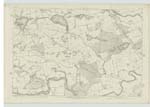
063 | "The name of this parish takes its name from its relative situation to the loch hard by it: the word, in the Gaelic language signifying the head of the loch. It is a curiously outlined irregular stripe stretching from north-north-west to south-south-east; and tapering at its southern extremity to a point which touches the angle of the north-east projection of Lethendy parish. It is bounded on the north by a detached part of Bendochy; on the east by the main body of Blairgowrie parish; on the north-west by a detached part of Blairgowrie parish; on the west and south by Clunie; and on the south-west by Caputh Parish. A Muir in the parish exhibits a vast number of tumuli called the "Haer Cairns", and has half addled the heads of many antiquarians by its stout claims to be regarded as the scene of the far famed battle of the Grampians. Kinloch and Lethendy parishes were Ecclesiastically united in the year 1806." Fullarton's Gazetteer |
Continued entries/extra info
Page 1There is no portion of this parish
detached, but two detached portions
of Caputh Ph. [Parish] are contained within
the boundary of this Parish.
Transcribers who have contributed to this page.
Alison James- Moderator, Invicta2, DANIALSAN, Derek Wilson Hall
Location information for this page.
Linked mapsheets.