OS1/25/5/8


| List of names as written | Various modes of spelling | Authorities for spelling | Situation | Description remarks |
|---|---|---|---|---|
| FOREST OF ALYTH | Forest of Alyth Forest of Alyth Forest of Alyth Forest of Alyth Forest of Alyth |
County Map Duncan McLachlan, Blackhall George Howieson, Rannagulzion William Ferguson, Corb Plan of the Forest of Alyth, by John Leslie 1765, in possession of D.H. Halkett Esqr. |
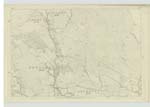
042 | This well known name applies to the upper and north-western part of the parish. The western portion sloping towards the Black Water, is mostly cultivated and contains the farms of Blackhall, Upper Blackhall, Haugh of Blackhall (formerly called Haugh of the Forest), Sheatdrum, Drumturk and Kingseat and generally termed the west forest (West Forest old Estate Plans in possession of D.H. Halkett Esqr. Balendoch) the remainder being a track of moorland interspersed with several mosses the principal being Culponach Moss. It extends on the north along the county boundary, from Burn of Drumturn passing the features of Bedigrow Burnt Cairns to Knockton (sheet 33). On the east still along the County Boundary, from Knockton and Hare Hill to Black Hill, thence across Burn of Watersheal, to Whin Craigie and Hill of Three Cairns produced to Burn of Alyth on sheet 42 (The portion from Black Hill to Burn of Alyth, described on (Judicial Plan in possession of D.H. Halkett C.E. Balendoch) as "boundary of old forest.)" On the South from Burn of Alyth westward by the woods of Tullymurdoch to Plan 42.16 Olies Burn Plan 42.11) along it to stone wall, thence north wall to parish road and Broomhill (Ruins), from Broomhill to inclosures of Ramagulzion thence to Rough Burn and the Black Water 4210 trace 2. on the West, northward along Black Water, to Burn of Drumturn thence along it to junction of County Boundary with the same. The eastern or upper boundary of what s called the West Forest, extends along stone wall from point where Undefined boundary, of wall produced joins Rough Burn (Plan 42.10 trace 3) which crosses Parish roadto point where it joins Burn of Drumturn, north of the farmhouse of Upper Blackhall, 42.6 trace 3. The western Black Water |
Continued entries/extra info
[page] 8Ph. [Parish] of Alyth County of Perth
The forest of Alyth an extensive
track of moor and moss seperating
the lowland from the highland
part of the parish. New Statistical Account.
Transcribers who have contributed to this page.
DANIALSAN, Brenda Pollock
Location information for this page.
Linked mapsheets.