OS1/25/5/47


| List of names as written | Various modes of spelling | Authorities for spelling | Situation | Description remarks |
|---|---|---|---|---|
| MCRITCH | McRitch McRitch McRitch McRitch Macheriech |
David H Halket Esqr. Factor The Hon [Honourable] Capt. [Captain] W. Ogilvy of Loyal Pro. [Proprietor] William Doig Occr. [Occupier] Val. [Valuation] Roll (1862) County Map |
053 | A farm house having offices attached. The property of the Hon, [Honourable] Captain William Ogilvy of Loyal |
| BRAE OF SHANGIE | Brae of Shangie Brae of Shangie Brae of Shangie Breashangie Brae of Shangie |
David Morrison Occr. [Occupier] David Low, Smith of Shangie David H Halket Esqr. Factor County Map Estate Plan |
053 | A row of Pld thatched Cottages on the farm of Shangie. The property of the Earl of Airlie. |
| BARRY HILL | Barry Hill Barry Hill Barry Hill Barry Hill |
David Low The Rev. [Reverend] James Ramsay D.H. Halket Esqr. Capt. [Captain] Ogilvy, Loyal |
053 | A tolerably sized hill on the Summit of which is a considerable fortification, in a good state of preservation, it is oval shaped and the rampart or mound appears to be chiefly constructed with small Stones and boulders on the South Side at the base of this mound, a ditch can be distinctly traced, and a few yards farther south is another mound or rampart the foundation of which is about 8 or 11 feet lower than the |
| FORT [Barry Hill] | Fort Fort on Barra Hill Fort on Barry Hill or Dunbarre Fort Barry Hill Fort Barry Hill Fort Barry Hill |
Capt. [Captain] Ogilvy, Loyal Pennant's Tour of 1772 p [page] 178 Wilson's Archaeology Brown's Histy. [History of the Highlands New & Old Stat [Statistical] Accounts Fullarton's Gazetteer |
053 | A tolerably sized hill on the summit of which is a considerable fortification, in a good state of preservation, it is oval shaped and the rampart or mound appears to be chiefly constructed with small stones and boulders on the south side at the base of this mound, a ditch can be distinctly traced, and a few yards farther south is another mound or rampart the foundation of which is about 8 or 11 feet lower than the |
| WELL [Barry Hill] | 053 | A tolerably sized hill on the summit of which is a considerable fortification, in a good state of preservation, it is oval shaped and the rampart or mound appears to be chiefly constructed with small stones and boulders on the south side at the base of this mound, a ditch can be distinctly traced, and a few yards farther south is another mound or rampart the foundation of which is about 8 or 11 feet lower than the |
Continued entries/extra info
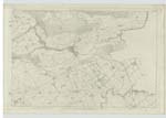
[Page] 47Plan 53-3 Parish of Alyth Perthshire
Transcribers who have contributed to this page.
DANIALSAN, Brenda Pollock
Location information for this page.
Linked mapsheets.