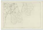
OS1/24/41/79
| List of names as written | Various modes of spelling | Authorities for spelling | Situation | Description remarks |
|---|---|---|---|---|
| FAR HILL | Far Hill Far Hill |
Robert Thorburn Esqr Juniper Bank Andrew Little Shepherd |
018 | [Situation] About ¾ of A Mile N.E [North East] of Middle Rig A large heathy hill on the farm of Juniper Bank, bounded east and west by Glenmead Burn & Glenpest - And North and South by the County boundary And East Bold Burn. |
| MINCHMUIR | Minchmuir Minchmuir Minchmuir Minchmoor or Minchmuir Minchmoor Minchmoor Minch Muir Minch Muir |
Robert Thompson Esqr Juniper Bank Andrew Little Shepherd Andrew Weatherstone Campshiel Gazeteer of Scotland (Fullarton) Parish Acct. [Account] "Origines Parochiales Scotiae" Johnston's Co [County] Map Armstrongs Co [County] Map |
018 | [Situation] About ⅝ of A Mile S.W. [South West] of Middle Rig A very elevated heathy hill over which the County boundary runs, there is a Trigonometrical Station on it - And on its Northern and North-eastern sides Are to be bound the drove Road & Cheese Well. |
| MIDDLE RIG | Middle Rig | Robert Thompson Esqr Juniper Bank Andrew Little Shepherd Thomas Armstrong Inverleithen |
018 ; 021 | [Situation] About ¾ of a Mile S.W. [South West] of Far Hill A heathy ridge of elevated ground on the farm of Juniper Bank - And situated to the west of Glenmead Burn, with Minchmuir Burn on its North. |
Continued entries/extra info
[Page] 79Parish of Traquair - Sheet 18 No 7 Traces 3, 4, & 5
Transcribers who have contributed to this page.
JOANMUIR
Location information for this page.


