OS1/24/40/7


| List of names as written | Various modes of spelling | Authorities for spelling | Situation | Description remarks |
|---|---|---|---|---|
| WEST BOLD | West Bold Bold West Bold Bold Boll |
Map attached to Pennecuiks Description Armstrongs Map Thomsons Atlas (Peebles) Edgars Map 1741 Timothy Pont's Map 1608 |
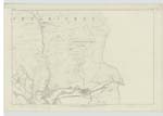
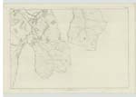
014 | [Situation] adjoins Haugh-head stretching Eastward along the right bank of Tweed A comfortable two storried farm house with a complete square of slated offices with thrashing Mill - all in excellent condition. - A farm partly arable - partly sheep walk - Earl of Traquair owner - William Gibson occupier. - |
| PLORA BURN | Plora Burn Plots Burn Plora Burn Ploraw Burn |
Thomsons Atlas (Peebles) Mr William Gibson, Farmer Plan of Bold in Lord Traquairs possession Thomsons Atlas (Selkirk) |
014 ; 018 | [Situation] A small Burn discharging itself into Tweed below the 10th Mile Stone from Peebles Plora Burn constitutes the boundary between Yarrow & Traquair from a point about ½ Mile from its source at Cheese Well to its intersection with the road from Peebles to Selkirk. - Its water drives the Thrashing Machine at W. [West] Bold. - |
Continued entries/extra info
[Page] 7Traquair Parish
Sheet 14 - 14 & 15
Transcribers who have contributed to this page.
DANIALSAN, JOANMUIR
Location information for this page.