OS1/24/29/36


| List of names as written | Various modes of spelling | Authorities for spelling | Situation | Description remarks |
|---|---|---|---|---|
| THE BANK | The Bank The Bank |
Adam Anderson Robert Hamilton |
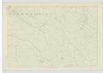
020 | [Situation] About 1 Mile N.W. [North West] of Sting Rig An Elevated Ridge of Heathy Pasture extending from the N. [North] base of Dollar Law Northwards parrallel to the Mannor Water to Newholmhopeb [Newholmhopeburn] |
| LANGHAUGH HILL | Langhaugh Hill Langhaugh Hill Langhaugh Hill |
Adam Anderson Robert Hamilton James Dodds |
020 | [Situation] About 1 Mile North of Sting Rig A large Hill on the Farm of Langhaugh at the E. [East] Side of Mannor Water and between Langhaugh Burn & Linghope Burn its surface is Heathy Pasture with a range of Scattered Rocks |
| WADDYSIDE RIG | Waddyside Rig Waddyside Rig |
Adam Anderson Robert Hamilton |
020 | [Situation] About 5/8 of A Mile N.E. [North East] of Sting Rig An Elevated portion of Heathy Pasture on the Farm of Langhaugh at the E. [East] side of LingHope, and extending from Langhaugh Hill to Black Cleugh Hill. |
Continued entries/extra info
[page] 36Parish of Mannor -- Sheet 20 No 4
Transcribers who have contributed to this page.
Moira L- Moderator, eddlerose
Location information for this page.
Linked mapsheets.