OS1/24/4/31


| List of names as written | Various modes of spelling | Authorities for spelling | Situation | Description remarks |
|---|---|---|---|---|
| GLENLOOD HILL | Glenlood Hill Glenlood Hill Glenloods Lawhead Lawhead |
Walter Melrose Holms Waterhead Alexander Thomson GlenKirK Armstrongs Co. [County] Map Johnston's Co. [County] Map |
019 | [Situation] About ½ Mile N [North] by [East] from Broomy Law A large and Conspicuous hill Covered with heath, and along its Summit runs the boundary between the parishes of Glenholm and Drumelzier. A Trigl [Trigonometrical] Station also stands on the top. |
| BARROW RIG | Barrow Rig Barrow Rig |
Alexander ThomSon Glen KirK Thomas Brown Copse Head |
Applies to a Rig or hill, on the farm of Kingledoons. It is covered with heath And on its Summit runs the boundary between the parishes of Glenholm & Drumelzier |
Continued entries/extra info
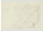
[Page] 31Glenholm Ph [Parish] -- Sheet 19 No [Number] 7 Trace 2
Barro Rig [note on page] in p. [page] 12
Cocklie Rig [note on page] in p. [page] 16 -- For descriptive remarks See common plan
Transcribers who have contributed to this page.
Bizzy- Moderator, P Wills
Location information for this page.
Linked mapsheets.