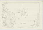
OS1/23/18/4
| List of names as written | Various modes of spelling | Authorities for spelling | Situation | Description remarks |
|---|---|---|---|---|
| GALT NESS | Galt Ness Galt Ness Galt Ness Galt Ness Galt Ness |
Major Calder, Factor, Shapinshay William Bews, farmer, Parkhill John Swanny, farmer, Troynhead Admiralty Chart Imperial Gazetteer Johnstons Map of Orkney Handbook to the Orkneys |
096 | Applies to the extreme point of The Galt, a narrow neck of land or promontory, forming the most north-western part or point of Shapinshay. |
| GALT SKERRY | Galt Skerry Galt Skerry Galt Skerry Galt Skerry Galt Skerry |
Major Calder, Factor, Shapinshay William Bews, farmer, Parkhill John Swanny, farmer, Troynhead Admiralty Chart Imperial Gazetteer Johnstons Map of Orkney Handbook to the Orkneys | 096 | Applies to a large low lying reef a little more than 1/8 mile north-east of Galt Ness; It is all covered at high water except a small portion at the south end. |
Continued entries/extra info
Parish of Shapinsay Shapinsay OrkneySigned: P. Dougherty 2nd. Corpl. [Corporal] R.E.
Transcriber's notes
'The Hen' All data on this has been scored through and cancelledTranscribers who have contributed to this page.
Quakecity
Location information for this page.
Linked mapsheets.


