OS1/21/45/13


| List of names as written | Various modes of spelling | Authorities for spelling | Situation | Description remarks |
|---|---|---|---|---|
| RIVER NETHAN | River Nethan River Nethan River Nethan Nethan Water |
Rev A McNaughton Mr D. Campbell Mr J Blair Forrests County Map |
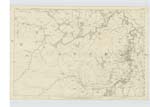
031 | A river which runs the entire length of the Ph [Parish] of Lesmahagow taking its rise on the S. [South] side of a hill named Nutberry at the Southern extremity of the Ph [Parish] and joining the Clyde at the village of Crossford. Its banks are generally wooded - bed rocky - passes the village of Lesmahagow and through several large bridges, one of these - a railway viaduct of 130 ft in height and a short distance before its final junction with the Clyde flows past at the base of a line of cliffs - freestone - which reach the elevation of 300 ft. |
Continued entries/extra info
6 [left corner of header] 13 [right corner of header]Ph [Parish] of Lesmahagow [in header]
Transcriber's notes
River Nethan. No entry appears in the column headed Situation, although the pre-populated entry 031 correctly indicates the map sheet on which it is depicted.Transcribers who have contributed to this page.
JCB
Location information for this page.
Linked mapsheets.