OS1/20/77/3


| List of names as written | Various modes of spelling | Authorities for spelling | Situation | Description remarks |
|---|---|---|---|---|
| KAUGH MOSS | Kaugh Moss Kaugh Moss Kaugh Moss |
William McMichael John Denniston Map of Property |
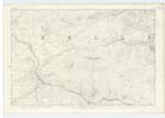
023; 030 | [Situation] About 1½ Miles N.N.W [North North West] of the North end of Loch Grennoch A considerable tract of Moss on the farm of Round Fell. Bounded on the South by Round Fell, on the East by Pallaugh Burn & on the North by the road leading from New Galloway to Newton stewart. The property- Stewart Morray Esqr. of Cally. |
| ROUND FELL | Round Fell Round Fell Round Fell Round Fell |
William McMichael John Denniston Ainsley's Map Revd. [Revised] 1819 Samuel McLelland Esqr. |
030 | [Situation] About one mile N.W. by W. [North West by West] of the north end of Loch Grennoch. A large hill on the farm of the same name the Surface of which is rocky heathy pasture. On it is a Trigl. [Trigonometrical] Station Called by Trig. [Trigonometrical] Party 'Kitterick' It is from this Hill the farm took it's name. The property of - Stewart Morray Esqr. of Cally. |
Continued entries/extra info
[Page] 3Parish of Githon
Form 136 Page
15 Kaugh Moss
15 Round Fell
Transcribers who have contributed to this page.
Chr1smac -Moderator, DANIALSAN
Location information for this page.
Linked mapsheets.